


Peakhunter Pro Summit Log app for iPhone and iPad
Developer: Peakhunter AG
First release : 29 Sep 2015
App size: 0 Bytes
2 Free Map Regions:
With the purchase of Peakhunter Pro you get 2 Map Regions of your choosing for free.
=== Note: Currently, the offline Peakhunter Topo Map is available only for the following countries: Switzerland, Austria, Germany, Italy ===
Pro Features
- Completely new look for the Map tab
- Peakhunter Topographic Map (based on OSM) – Currently only CH, AT, DE, IT
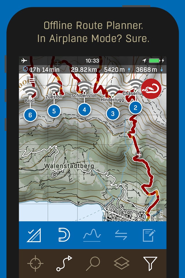
- Download maps with routing for offline use
- Plan routes directly on your phone, also offline
- Plan along paths or freely cross-country
- Calculation of height gain/loss, time and length
- Elevation Profile with SAC Mountain and Hiking Ratings (where available)
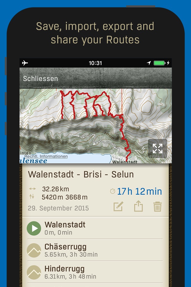
- Save your routes and share them, export as gpx
- Import gpx (just use open in ... and select Peakhunter Pro)
- Search for peaks and other waypoints, as well as localities
- Filter: e.g. only show the places you reached
- Set your average speed for routing calculation
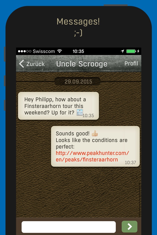
- Messages: Directly communicate with others
Basic Features
- Bag peaks with GPS verification.
- Map: with peak location, compass and distance grid
- Explore: Quickly see whats going on around you
- Fit for the outdoors! No network needed. Works offline.
- Download peak data (for offline use)
- Create new peaks (will be verified) and other waypoint types
- Share your happy moments with others
- Browse summit logs of fellow peak baggers
- Add your pre-Peakhunter adventures on peakhunter.com
Peakhunter (peakhunter.com) is the Premiere Digital Global Summit Log.
The Peakhunter App only lets you create an entry while standing on a peak. That proves that you have climbed it (GPS location, time stamp). Write about your experience and let other fellow hunters know about the conditions, take photos, share it with others on facebook.
Conveniently keep track of all peaks you ascended.
The app works WITHOUT cellphone network! It uses GPS only to confirm your exact location.
You can download all peaks (without map data) for a country. That makes them available offline (when you have no internet).
We hope to roll out the Peakhunter Topo Map for other countries soon!
We have over 300000 peaks in our database.
Mind you: Theres no source for accurate positions of all peaks in the world, yet.
We want to change that by harnessing crowd sourced GPS data.
Help us build the most comprehensive database on peaks on the planet!
If you find a peak that doesnt exist or is in the wrong place, create a new one.
All newly created peaks will be verified by us and other users.
All peak logs can be browsed on peakhunter.com.
You can add past logs on peakhunter.com. But they do not count in current statistics and challenges.
Get Started
1) Install the App
2) Register an account
3) Climb a peak
4) Log it!
This service will be constantly updated with new features.
We look forward to your suggestions! Send them to [email protected]
For News follow us on twitter or facebook.
The Peakhunter service is free.
Have fun and be safe!
Your Peakhunter Team